GLM Imagery
  • Home (current)
  • Enthusiasts
  • Forecasters
  • Real Time
  • DIY


  • GLM Imagery Examples

    This website provides imagery examples from the Geostationary Lightning Mapper (GLM) to help illustrate the value of these data. Please follow the tabs above to explore this imagery.

    Este sitio web proporciona ejemplos de imagenes del Geostationary Lightning Mapper (GLM) para ayudar a ilustrar el valor de estos datos. Por favor, siga las pestanas de arriba para explorar estas imagenes.
  • Daily GLM Videos

    Videos of the most interesting flashes and storm regions observed by both the GOES-East and GOES-West GLMs are archived daily. GOES-16 videos also are created daily for both CONUS and full-disk perspectives. Links to dropbox folders follow.


    GLM flashes (current background)
    GLM storm areas

    CONUS View (front page background)
    FD View

    Targeted Dropbox Selections

    Videos diarios de GLM

    Todos los dias se archivan videos de los destellos y regiones de tormenta mas interesantes observados por los GLM del GOES-Este y del GOES-Oeste. Los videos GOES-16 tambien se crean diariamente para las perspectivas de CONUS y de disco completo. Los enlaces a las carpetas de Dropbox siguen.


    Destellos GLM
    Areas de tormenta GLM

    Vista CONUS
    Vista FD
    Selecciones de Dropbox dirigidas

    Double Click Video For Full Screen

    Mobile: Link to YouTube Playlist

    -

    Double Click Video For Full Screen

    Mobile: Link to YouTube Playlist
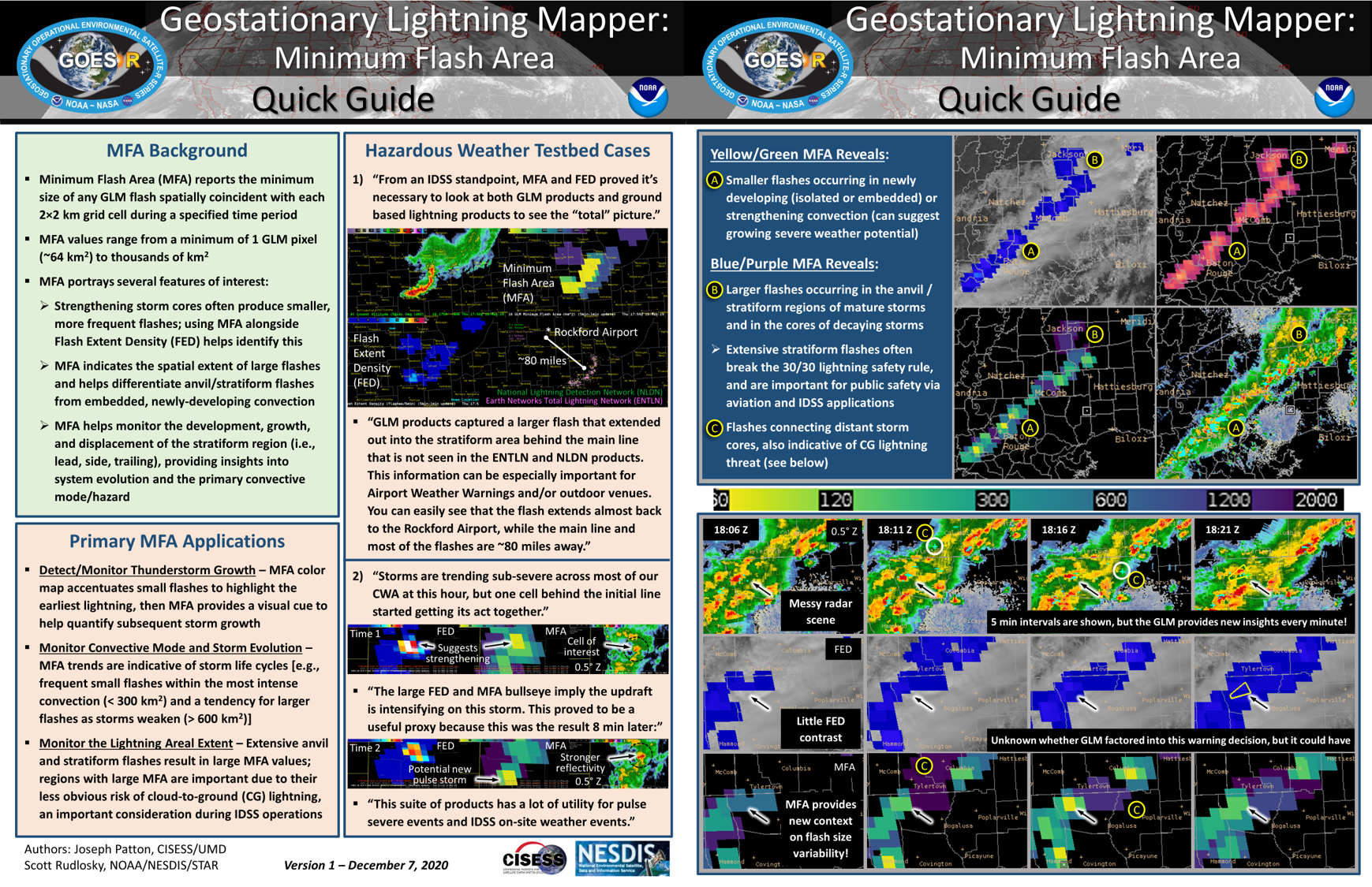
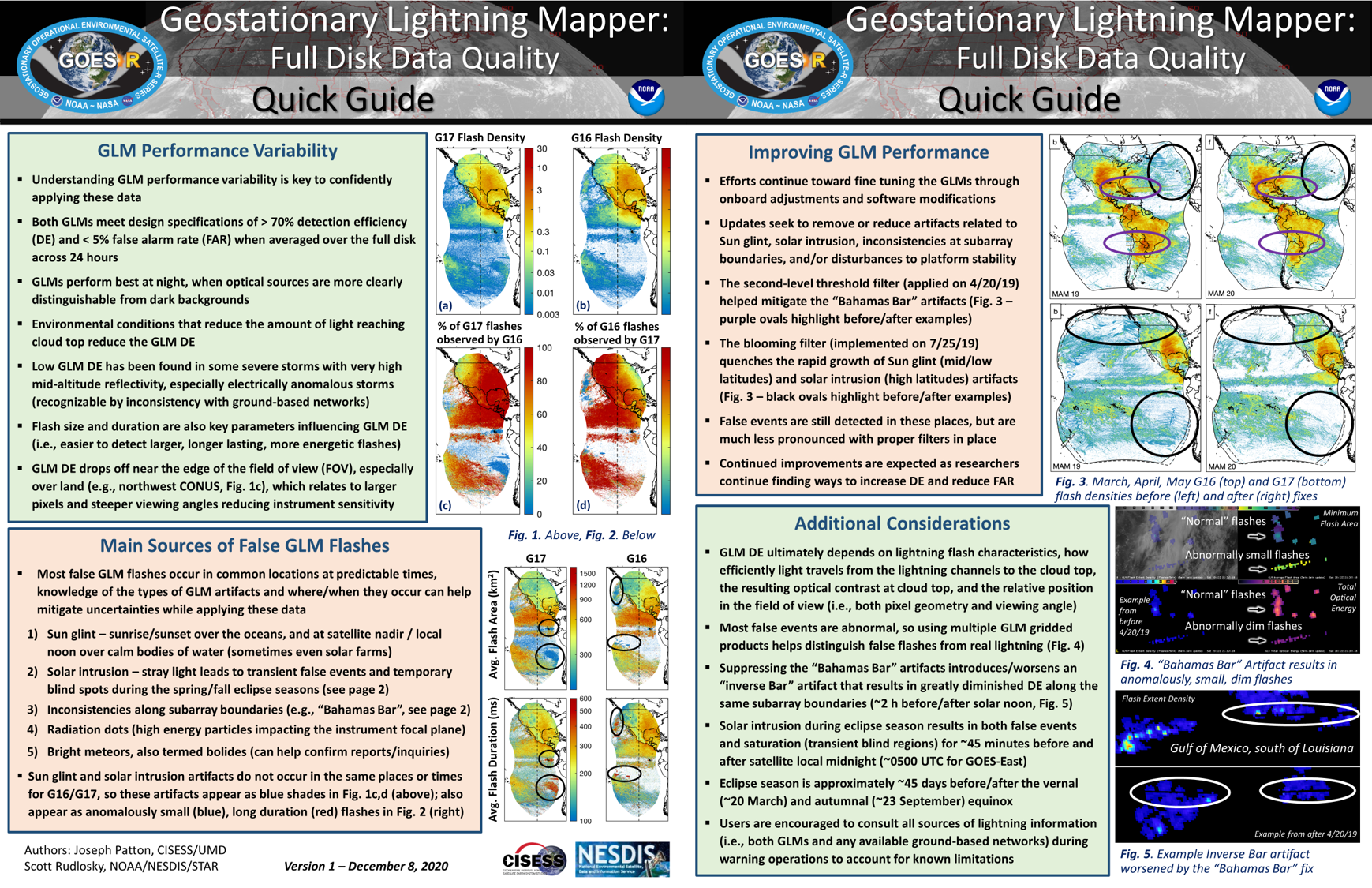
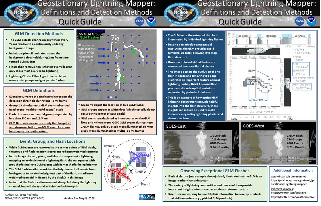
  • Training Guides

    Image
    Image
    Image

    Image
    Image
    Image
    Image

    AWIPS Movies

    Double Click Video For Full Screen

    Mobile: Link to YouTube Playlist
    Link to additional training materials
  • NESDIS STAR


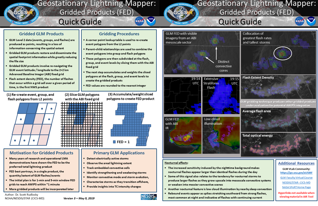
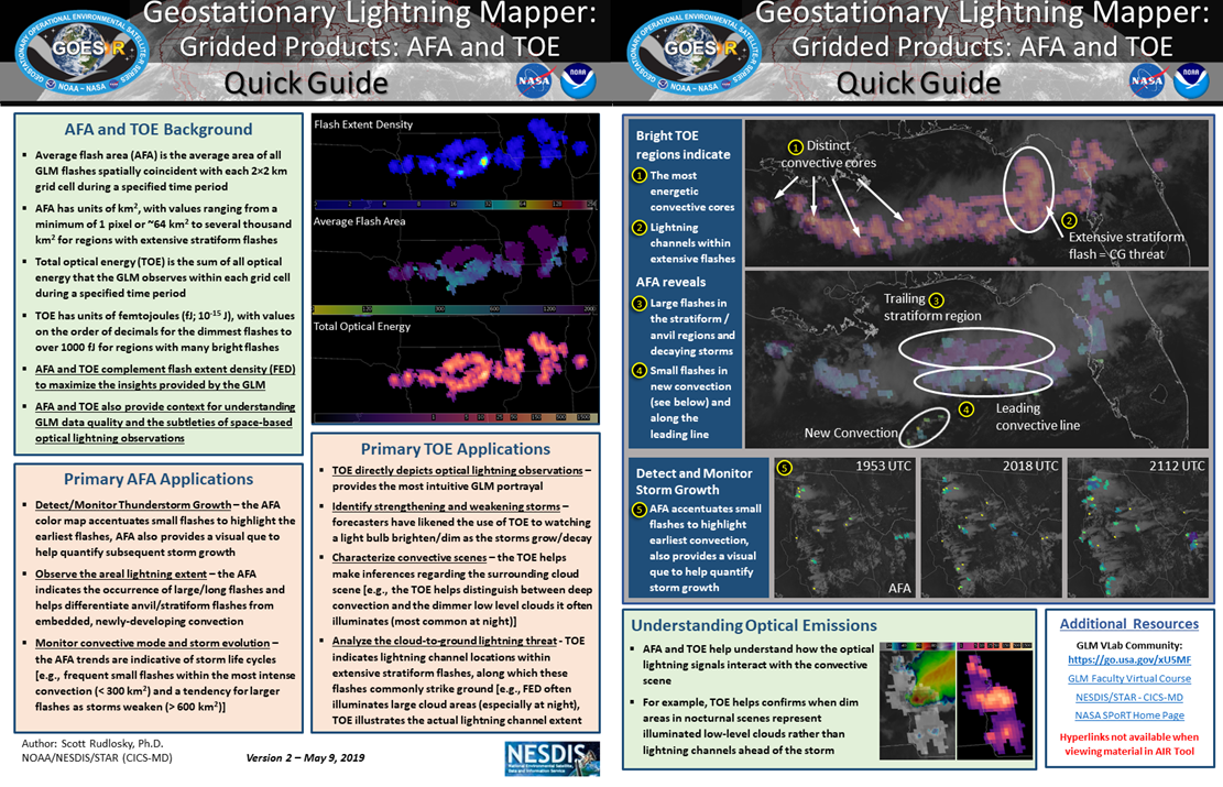
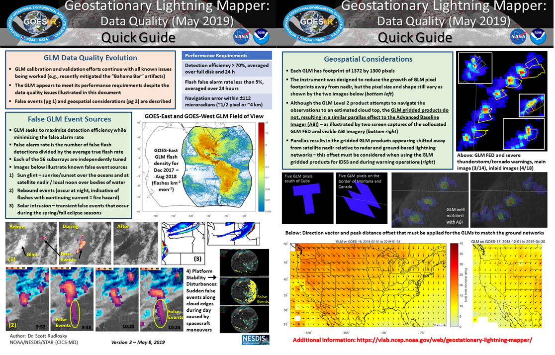
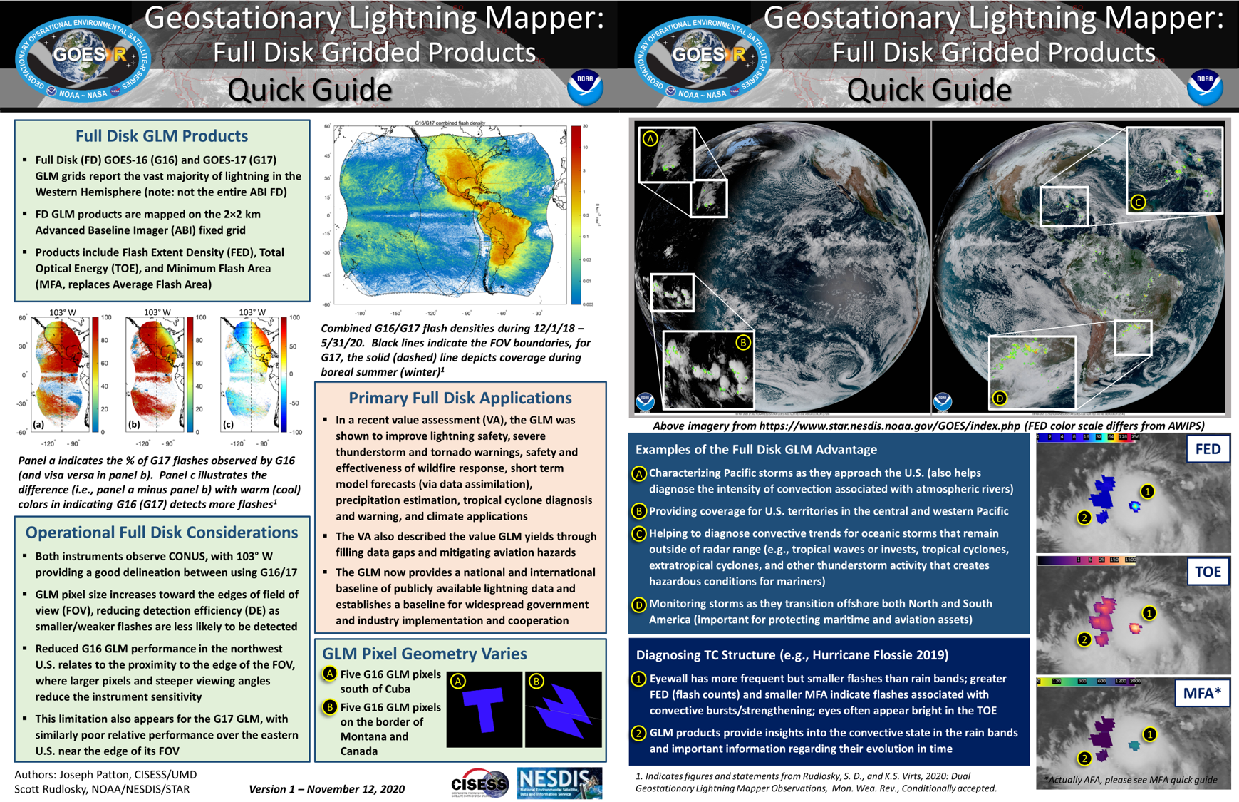
    The NOAA/NESDIS/STAR GOES Image Viewer provides real-time access to imagery from both GOES-East and GOES-West. This imagery combines the gridded GLM products with ABI observations. The GLM aspects of this site are still under development, and new imagery options will be added as they become available.


    CONUS

    Full Disk

    CIRA Slider


    The Satellite Loop Interactive Data Explorer (SLIDER) is a great new tool for viewing GOES-16/17 imagery including the GLM. Two products are viewable (group energy density and group flash count density), with both indicating lightning occurrence and intensity. The physical interpretation of the group energy product is still being studied.


    CONUS

    Full Disk

    Weathernerds


    Weathernerds provides real-time weather data in a flexible, practical interface designed to give creativity and control to the user. This site provides access to both the Level 2 flash locations and gridded products (FED and TOE), which can be overlaid on various imagery and easily exported for use on social media.


    Level 2 Points over IR

    Gridded FED over VIS

  • Data Access


    Level 2 (events, groups, flashes)


    GOES-16/17 on Amazon Download Page (University of Utah)

    Alternate Download Page (University of Utah)


    Gridded GLM Products


    Real-time GLM East (CONUS) gridded (imagery) products (via Texas Tech and Unidata)

    Archive AWIPS Compatible Files for GOES East and GOES West

    Tools


    GLM Tools (Bruning/TTU)


    Github
    Examples

    FYI


    Ground System Status


    GS Change/Update Timeline

    G16 GLM Product Performance Guide

    G17 GLM Product Performance Guide

    References


    Initial Geostationary Lightning Mapper Observations

    Dual Geostationary Lightning Mapper Observations

    GLM Reference List

  • i

Copyright © 2019 University of Maryland